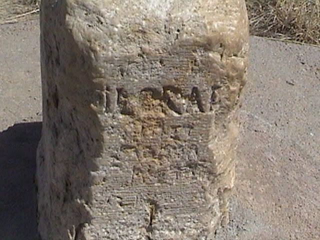
 The sandstone marker is Chaffee's Corner. It measures 6 ft. long, but only has 3 feet exposed. It has 40 Degrees North on the east side of it and 25 Degrees West on the south side, with the word Colorado on the west side. It was set in 1869.
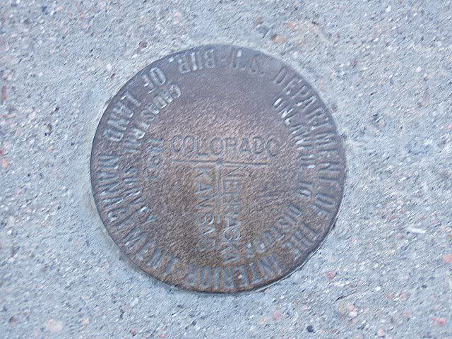 There is also a marker of three corners where KS/CO/NE come together. This marker was set by the Bureau of Land Management on June 15, 1873.
This area, known locally as Three Corners, is on property owned by Rex Daniels, Haigler, Nebraska.
On Hiway 34 go to Road RR just east of Laird, Colorado, go south on Colorado county road RR for about 6 miles, then turn east at the T on road 31 for about ½ mile where you will come to a cattle guard. Cross the cattle guard and travel south east along the gravel road for another ½ mile where you come to a fence and a windmill on the left, bear left to the top of a low ridge and follow the dim road to the marker. (Some hiking may be necessary) Please respect the property and leave it as you found it.
Three corners can also be approached from Devil’s Gap by going across the Arikaree River bridge and bearing west, then north to Colorado Road 31.
I've been to 3 Corners a couple of times, can't seem to recall Chaffee's Corner.
ReplyDelete